Teledyne PDS Magnetometer provides all necessary functionality to perform a survey accurately and fast. It is also part of the Teledyne PDS single beam or multibeam. This turnkey solution offers the surveyor a strong tool to carry out the survey efficiently. Survey planning, data acquisition, data processing, editing, and chart production are all part of the software, which makes it easy to use.
Teledyne PDS can interface to multiple magnetometers and output the data to standard formats to be used in software programs for interpretation.
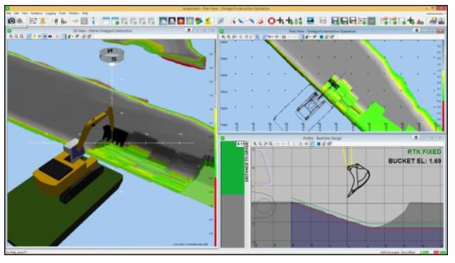
During data collection, the covered area is displayed real time in top, profile, and 3D views using a color-coded digital terrain model (DTM). Quality control displays reassure the operators that the data is of the desired quality. The line base editing modules offer operators the right tools for data editing and cleaning.
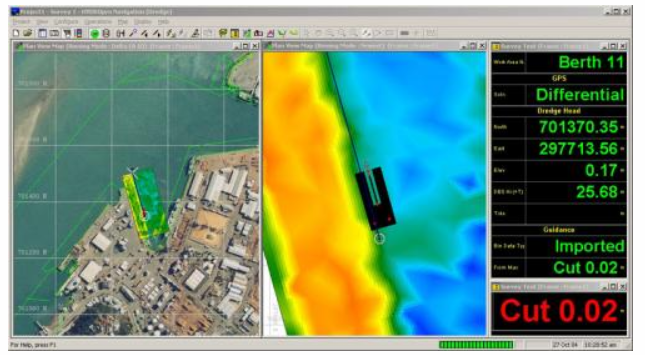
After data processing, DTM models can be generated, interpolations can be done, and your data is available for processing and export. The chart model offers the operator quick plot results for magnetometer surveys. More Info.
Main features