
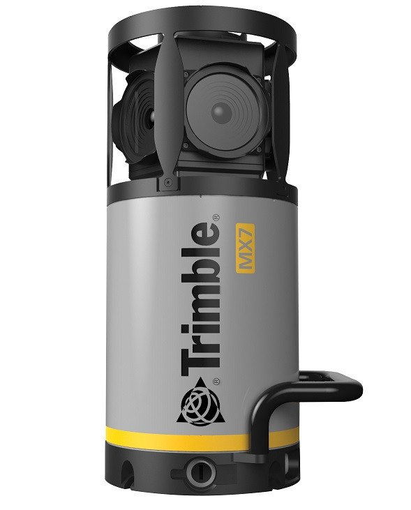
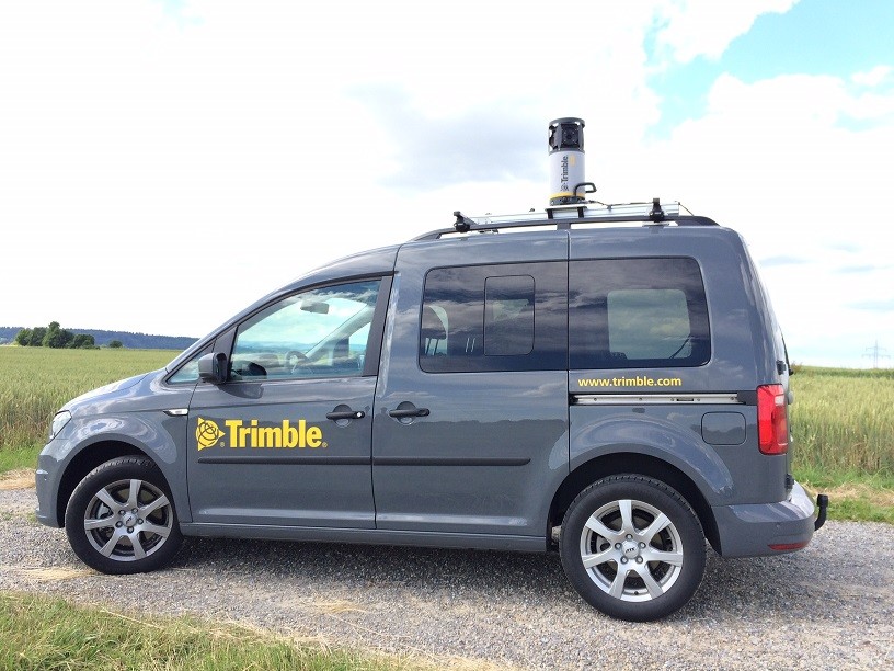
Trimble MX7 Mobile Imaging System is a fast and cost-effective way to manage assets such as bridges, buildings, roads, highways and power plants, and to document site conditions with georeferenced images.
Trimble MX7 is a vehicle-mounted photogrammetric system equipped with six 5 MP cameras and Trimble Applanix GNSS modules and inertial georeferencing. Trimble MX7 can be deployed on vehicles of all sizes, allowing you to capture geo-referenced 30 MP images at highway speeds.
Trimble MX7 lets you visually observe and capture the job site, and later produce deliveries to the office using Trimble Trident MMS and Applanix POSPac™. Trident Imaging Hub software is available with the system and provides robust positioning of objects, measurements, creation of data layers, 3D models and georeferenced image analysis


.png)